Anna Keen is Wandering the Wilderness during the Totally Thames Festival 2022 in RSPB Rainham, 18 miles from central London. ART Road-Signs are waypoints set outside in the landscape and hidden in the Bird Hide. The strangely beautiful architecture of the RSPB’s iconic, carbon neutral building and cafe is set like a jewel in this urban fringe environment of Outer East London.
Opening hours visitor centre and reserve: 9.30 am – 5 pm
Address: New Tank Hill Road, Purfleet, Essex, RM19 1SZ (directions)
Tel: 01708 899840
The strangely beautiful architecture of the iconic RSPB Rainham’s carbon neutral building and cafe is set like a jewel in this urban fringe environment of Outer East London. It attracts people to the marshes to watch its 250 species of birds and to walk in this ancient landscape, neither quite water nor land. Dominated from afar by the huge alien Rubbish-Mountain of Rainham landfill (which is too human for comfort), London’s huge glass towers shine gold and silver in the blue ultramarine distance. You see the snarling, greedy skyscrapers from the Isle of Dogs and in your hazy vision appears The Axe, The Scalpel, The Shard and The Razor, which all slash and gash and cut. Feverish activity throbs through the veins and arterial routes of the city and the enflamed soft-tissues of England stretch out far into the seething immensity of The Thames’ Estuarine Wilderness.
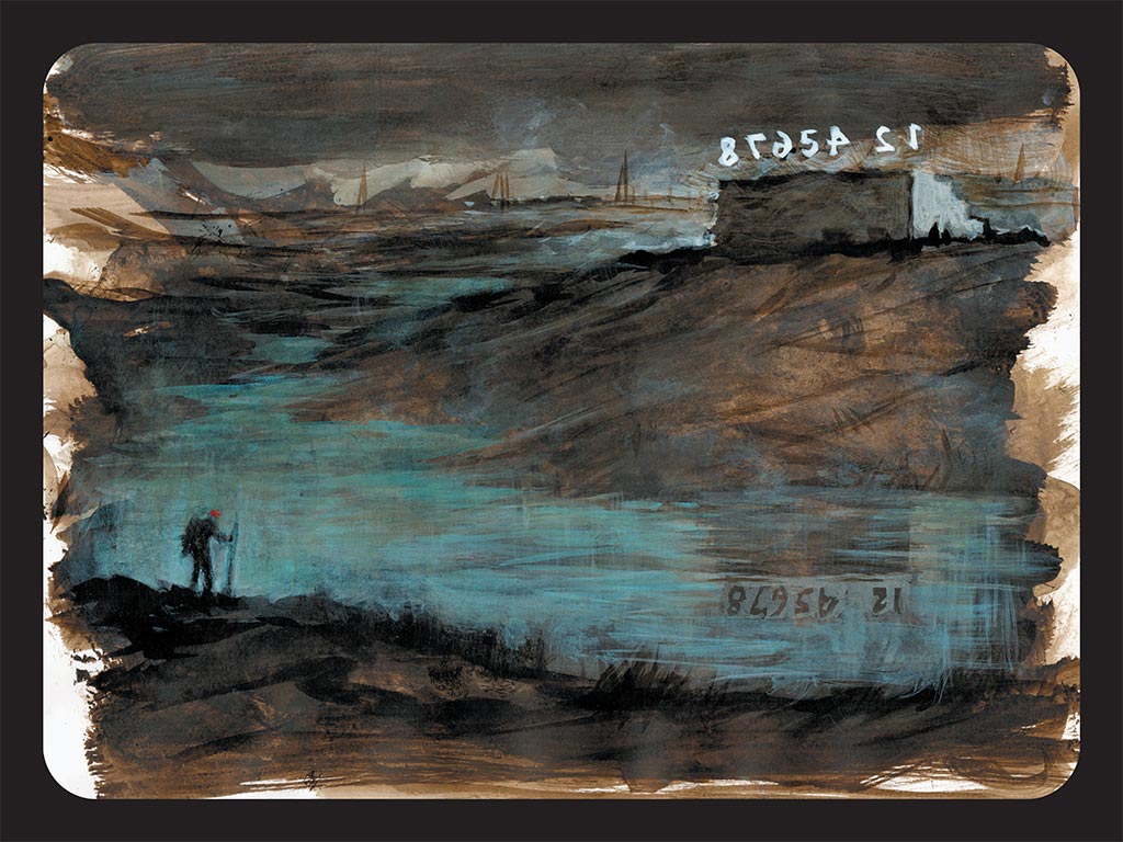
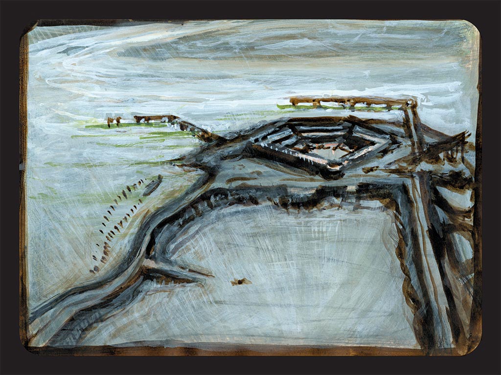
This is the last and only remaining Rifle Range on all the surrounding marshes. There were 6 blocks of 8 numbers each on Rainham Marsh as well as the 5 blocks on Avery Marsh. All the others have been knocked down.
In the distance is the Dartford Crossing of The Thames and the Dartford Flood Barrier, which crosses the river Darent near Erith.
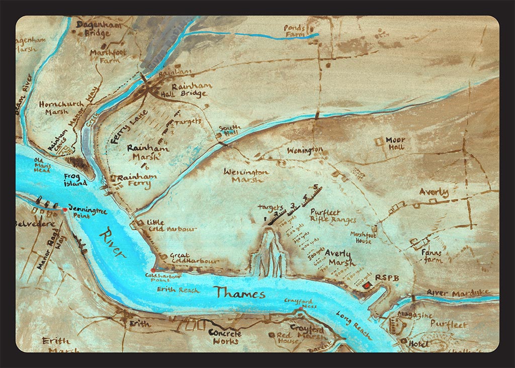
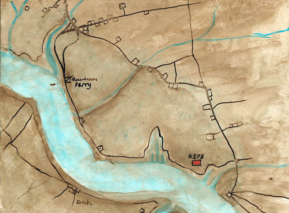
Drawn from several ancient maps, I made a map to help me understand the terrain and history of these Ancient Marshlands.
Cliffe Fort was built on the South bank of The Thames marshes in the 1860s. Due to the waterlogged conditions, outbreaks of malaria and bronchitis were persistent problems for the workforce. In August 1864, after visiting the site, The Chief Royal Engineer wrote: “The officers’ quarters at Cliffe are a mere hut, an abominable stinking place in summer, very cold and wet in winter. It stands by the side of a foul ditch which cannot be cleaned, for the mere disturbing of its contents would endanger the health of the officers.”
After 1887, a launching station for the Brennan torpedo “the world’s first practical guided missile” was added to the fort. A large concrete room was built onto the front of the fort to store the torpedoes, which were launched from a rail mounted on the roof of the torpedo room. Two slipways were built at different times, the second being added most likely in the 1900s, along with a telescopic control tower on the roof to direct the torpedoes. Only one of the slipways now survives. The War Office sold Cliffe Fort in the 1950s or 1960s to the owners of a large aggregates works. It is not open to the public and is fenced off, though its exterior is accessible via the Saxon Shore Way coastal path. The RSPB manage the nearby Cliffe pools: 75 ha of grassland on in-filled lagoons and 5 ha of dense scrub.
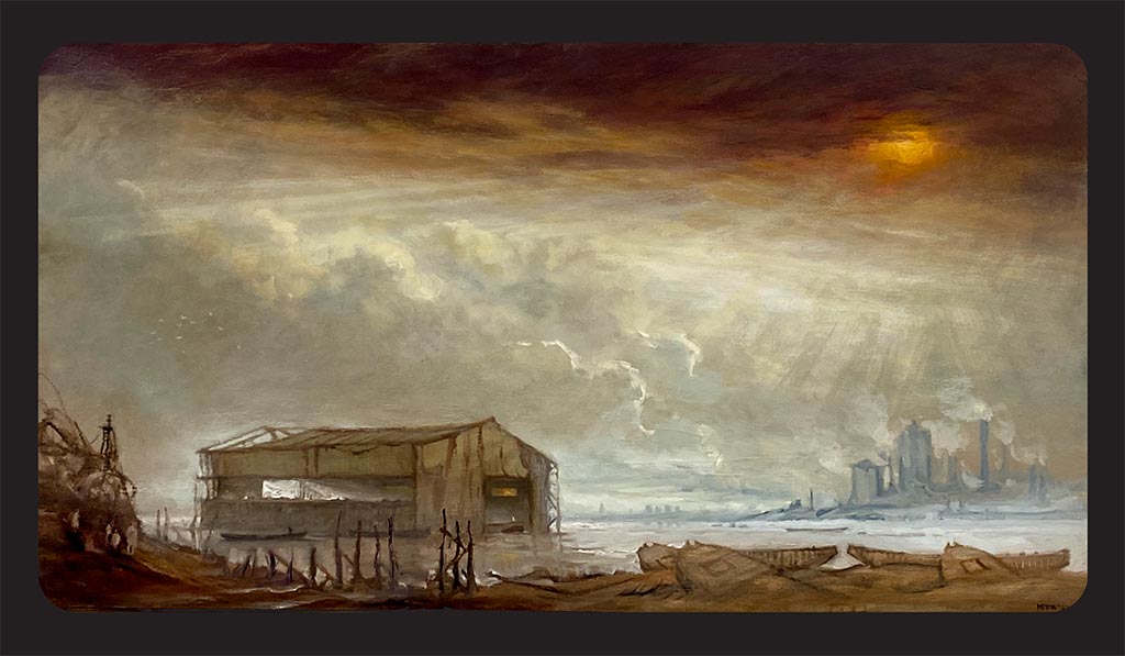
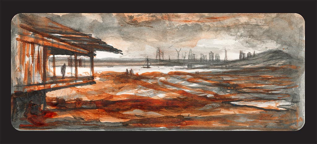
Waste Disposal Water-Shed Rainham landfill was in continuous use for over a century and once required a fleet of locomotives to move the waste into position. The Waste Disposal Shed on the Thames, receives barge loads of London Waste to build up the Rubbish Mountain. It is run by Veolia.
Wander down Ferry Lane from Rainham towards Cold Harbour point, to where The Ferry House pub was. Later named the Three Crowns, it was first recorded in 1556. Before the 19th century there was little industry in Rainham, although a boat-builder and two tanners were recorded in the 16th century.
But from 1869 Rainham Ferry provided a suitable location for obnoxious chemical and fertiliser factories. By 1886 there were 6 works, 2 fronting the creek, and 4 on the Thames. Salamon & Co. occupied a creek site from c. 1880 to 1971; the company refined crude tar, but with the introduction of North Sea gas, coal carbonization ceased, and crude tar was no longer available. On the river-front the 3 main firms have been Hempleman & Co., blood- and fish-manure manufacturers (1882–c. 1917); J. C. and J. Field Ltd., candle and soap manufacturers (1906–c. 1937); and Murex Ltd., iron-founders and ferroalloy manufacturers. Murex, founded in 1909, moved to Rainham in 1917. Between 1928 and 1937 it bought out the other companies on the water-front, and in 1970, after further land-purchases, owned 63 a. In 1972 Murex was part of the British Oxygen Co. Between 1919 and 1939 there was also a barge-builder at the Ferry. In 1894 there was a brickfield on an unidentified site; and in the 1930s two sand and ballast companies were operating.

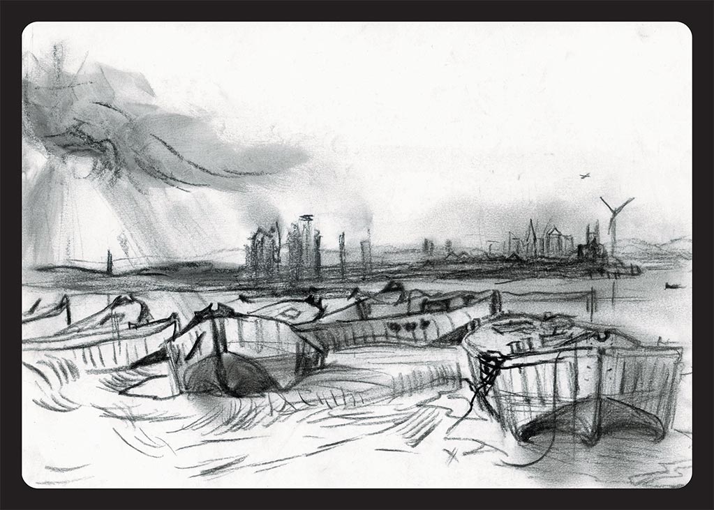
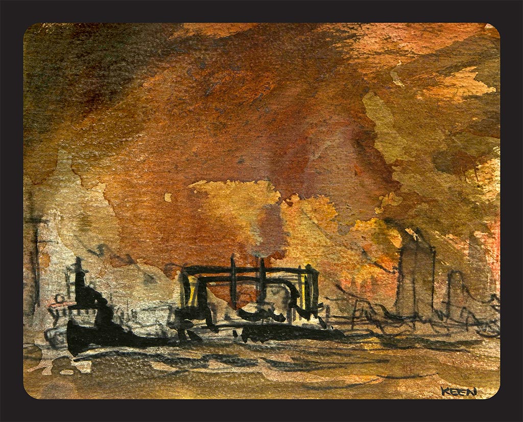
A group of half-sunken, ferro-cement lighters flounder in the marshes beside the Tilda Rice factory on Rainham Marsh. They are the remains of concrete, iron rod-enforced ships from World War II. Despite appearances, they are lighter than the water they displace, and so can float. The barges weigh 160 tons and were constructed on the London dockside before being craned into the water by the giant PLA crane Goliath. In 1953 they they were towed to Coldharbour Point and sunk to protect against flooding.
The industrial zone of Erith Belvedere Oil works sits on the marshes south of the river Thames. There are traces of prehistoric settlement and of a substantial community or farmstead from the 1st century AD. In Neolithic times the area was covered by a dense forest of oak, yew and alder, which by the Bronze Age had given way in part to sedge fen.
After 50 years serving London, the twin Woolwich ferries were towed unceremoniously to France to be scrapped. Turner would surely have painted the tragic last voyage of the contemporary ‘Fighting Temeraires’.

Barking Creek runs alongside Beckton Sewage Treatment Works, which is now the largest in Europe, treating the wastewater of 3.5 million Londoners. The outfall boils and bubbles, toils and troubles itself along miles of stinking channels before voiding its darkness into the Thames.
Forming part of Havering Riverside and bordering the Thames just west of Purfleet, are the Aveley, Wennington and Rainham marshes.
The artist Anna Keen is Wandering the Wilderness for the Totally Thames Festival 2022 in the RSPB Rainham, 18 miles from central London. Her Road-Signs are artistic waypoints set outdoors in the landscape and hidden in the wooden bird-hide. The strangely beautiful architecture of their iconic, carbon neutral building and cafe is set like a jewel in this urban fringe environment of Outer East London. Attracting people to the marshes to watch its 250 species of birds and walk in its ancient landscape, neither quite water or land, dominated from afar by the huge alien Rubbish-Mountain of Rainham landfill, which is too human for comfort.
There are many traces of Iron Age and Roman occupation in these marshes. Aveley is north of the river Mardyke (which as late as 1760 was tidal for about 5 miles). The remains of prehistoric elephants found there during gravel digging are displayed at the Natural History Museum in London.
In 1273 Aveley manor had a gallows and a rabbit warren. There were two ale-tasters from 1519 to 1686, plus a poundkeeper, responsible for catching and ‘impounding’ stray livestock in the common pound, a ducking stool and a whipping post. In 1773 Marshfoot House was leased as a workhouse. From 1806 Aveley, West Thurrock, and Rainham leased Noke House, Wennington, as a joint workhouse. Harry Noke of Upminster, by will proved in 1595, gave 20 lambs as stock to buy bread for the poor of Aveley and West Thurrock. In 1760, when the government was planning the powder magazine at Purfleet, an engineer reported that the Mardyke was very badly drained, mainly because the water mill at its mouth penned in the tides for 6 hours in 24. The mill was demolished in the following year. By the later 16th century the marshes were governed by a Court of Sewers whose jurisdiction extended from West Ham to Mucking. Aveley level, which formed part of that area, in 1563 ran from Rainham bridge to Grays’ bridge.
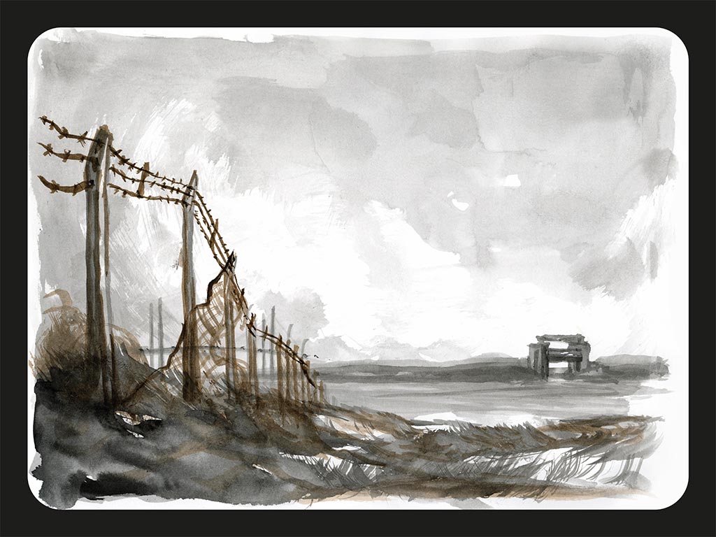
There was an extensive WW1 army training camp, a military hospital and the site of an anti-aircraft gun on the marshes. Purfleet Heritage and Military Centre is inside an enormous gunpowder magazine built in 1759 to store and supply the Navy and the Army. Their museum collection has a wide range of local history and military topics from the eighteenth century to the present day. On the RSPB site were the firing ranges. Huge structures with 8 huge 2m high wooden letters on each block. There were 5 blocks on Averly Marsh and 6 blocks on Rainham marsh. Both facing inwards towards each other, with markers every 100 yds for aiming. The numbers could be seen backwards from the A13 and in this surreal and desolate landscape, sometimes a number would blow away, a sign and a portent…”The night…is filled with bestial watchmen, trammelling the extremities and interstices of the timeless city, portents fallen…” Samuel Delany
Ferry Lane still leads over the marshes from Rainham bridge and Rainham Manor (now owned by the national Trust) down to where the ferry was moored at the mouth of Rainham Creek in front of Frog Island. The ferry would cross towards Jenningtree Point near Erith on the other side of The Thames. Between the Tilda rice factory (built in the 1980’s) and the landfill barge’s water-shed, are a whole fleet of scuppered concrete barges stranded on the mud. These were used as part of a Mulberry harbour during the Allied invasion of Normandy in 1944. The barges were utilised to shore up flood defences in 1953 but are now abandoned. Waste from London is brought up the Thames in barges and deposited in Coldharbour’s hinterland. Further along towards the RSPB, is Coldharbour Point, and both Little Cold Harbour and Great Cold Harbour are marked on a map from around 1560.
The London Loop is a walking route of about 150 miles that entirely encircles Greater London, beginning at Erith and ending on the opposite bank of the river at the RSPB visitor centre.
RM19 1SZ Purfleet
United Kingdom