Tilbury Hailing and Power Stations

Tilbury Hailing and Power Stations, Oil on Canvas, 220 cm x 185 cm

Looking East towards the North Sea from Tilbury Fort at the end of the 1970’s, one could see this historical landscape. The little red and white hut perched on top of a skewed pillbox was the Collier Hailing or Signaling Station and the 4 huge chimneys belonged to both Tilbury A & Tilbury B Coal Fired Power Stations. In the Millennium year 2000, I went sketching in Tilbury. Looming large above Tilbury Fort were the two remaining 168m high chimney stacks from Tilbury B, belching thick clouds of black smoke high above the River Thames.

As I drew the piebald and skewbald gypsy horses, which still roam the old Common Lands, flecks of soot rained gently down on my white paper leaving trails of black when I wiped them off. All around me on Tilbury Marsh, gnarled trees and thorn bushes were festooned with colourful Rubbish-Flags: Long, shredded plastic ribbons which slowly undulated like ghostly ships‘ pennants, and hundreds of trapped plastic bags leapt and shook, full of crinkly joy at having broken free from an indefinite imprisonment in the nearby, gloomy, historic, long-unmonitored landfill of Goshem’s Farm.

anna-keen-thames-estuary-map-tilburry-fort

RSPB Rainham

rspb-logo-grey

Anna Keen is Wandering the Wilderness during the Totally Thames Festival 2022 in RSPB Rainham, 18 miles from central London. ART Road-Signs are waypoints set outside in the landscape and hidden in the Bird Hide. The strangely beautiful architecture of the RSPB’s iconic, carbon neutral building and cafe is set like a jewel in this urban fringe environment of Outer East London.

Opening hours visitor centre and reserve
: 9.30 am – 5 pm
Address: New Tank Hill Road, Purfleet, Essex, RM19 1SZ (directions)
Tel: 01708 899840

MORE INFO

anna-keen-rspd-rainham
b) RSBB Rainham

The strangely beautiful architecture of the iconic RSPB Rainham’s carbon neutral building and cafe is set like a jewel in this urban fringe environment of Outer East London. It attracts people to the marshes to watch its 250 species of birds and to walk in this ancient landscape, neither quite water nor land. Dominated from afar by the huge alien Rubbish-Mountain of Rainham landfill (which is too human for comfort), London’s huge glass towers shine gold and silver in the blue ultramarine distance. You see the snarling, greedy skyscrapers from the Isle of Dogs and in your hazy vision appears The Axe, The Scalpel, The Shard and The Razor, which all slash and gash and cut. Feverish activity throbs through the veins and arterial routes of the city and the enflamed soft-tissues of England stretch out far into the seething immensity of The Thames’ Estuarine Wilderness.

anna-keen-purfleet-rifle-range
c) Purfleet Rifle Range, RSPB Rainham 

This is the last and only remaining Rifle Range on all the surrounding marshes. There were 6 blocks of 8 numbers each on Rainham Marsh as well as the 5 blocks on Avery Marsh. All the others have been knocked down.

anna-keen-dartford-creek
d) Old Military boundary between the Marshes, RSPB Rainham

In the distance is the Dartford Crossing of The Thames and the Dartford Flood Barrier, which crosses the river Darent near Erith.

anna-keen-map-rainham
e)  Detailed Ancient Map

Drawn from several ancient maps, I made a map to help me understand the terrain and history of these Ancient Marshlands.

anna-keen-cliffe-fort-framed
f) Cliffe Fort, the Hoo Peninsular

Cliffe Fort was built on the South bank of The Thames marshes in the 1860s. Due to the waterlogged conditions, outbreaks of malaria and bronchitis were persistent problems for the workforce. In August 1864, after visiting the site, The Chief Royal Engineer wrote: “The officers’ quarters at Cliffe are a mere hut, an abominable stinking place in summer, very cold and wet in winter. It stands by the side of a foul ditch which cannot be cleaned, for the mere disturbing of its contents would endanger the health of the officers.”
After 1887, a launching station for the Brennan torpedo “the world’s first practical guided missile” was added to the fort. A large concrete room was built onto the front of the fort to store the torpedoes, which were launched from a rail mounted on the roof of the torpedo room. Two slipways were built at different times, the second being added most likely in the 1900s, along with a telescopic control tower on the roof to direct the torpedoes. Only one of the slipways now survives. The War Office sold Cliffe Fort in the 1950s or 1960s to the owners of a large aggregates works. It is not open to the public and is fenced off, though its exterior is accessible via the Saxon Shore Way coastal path. The RSPB manage the nearby Cliffe pools: 75 ha of grassland on in-filled lagoons and 5 ha of dense scrub.

anna-keen-waste-disposal-water-shed
g) Waste Disposal Water-Shed

Waste Disposal Water-Shed Rainham landfill was in continuous use for over a century and once required a fleet of locomotives to move the waste into position. The Waste Disposal Shed on the Thames, receives barge loads of London Waste to build up the Rubbish Mountain. It is run by Veolia.
Wander down Ferry Lane from Rainham towards Cold Harbour point, to where The Ferry House pub was. Later named the Three Crowns, it was first recorded in 1556. Before the 19th century there was little industry in Rainham, although a boat-builder and two tanners were recorded in the 16th century.
But from 1869 Rainham Ferry provided a suitable location for obnoxious chemical and fertiliser factories. By 1886 there were 6 works, 2 fronting the creek, and 4 on the Thames. Salamon & Co. occupied a creek site from c. 1880 to 1971; the company refined crude tar, but with the introduction of North Sea gas, coal carbonization ceased, and crude tar was no longer available. On the river-front the 3 main firms have been Hempleman & Co., blood- and fish-manure manufacturers (1882–c. 1917); J. C. and J. Field Ltd., candle and soap manufacturers (1906–c. 1937); and Murex Ltd., iron-founders and ferroalloy manufacturers. Murex, founded in 1909, moved to Rainham in 1917. Between 1928 and 1937 it bought out the other companies on the water-front, and in 1970, after further land-purchases, owned 63 a. In 1972 Murex was part of the British Oxygen Co. Between 1919 and 1939 there was also a barge-builder at the Ferry. In 1894 there was a brickfield on an unidentified site; and in the 1930s two sand and ballast companies were operating.

anna-keen-sunken-barges-1
h)  Sunken Barges, Wire Diver, Landfill Water Shed

A group of half-sunken, ferro-cement lighters flounder in the marshes beside the Tilda Rice factory on Rainham Marsh. They are the remains of concrete, iron rod-enforced ships from World War II. Despite appearances, they are lighter than the water they displace, and so can float. The barges weigh 160 tons and were constructed on the London dockside before being craned into the water by the giant PLA crane Goliath. In 1953 they they were towed to Coldharbour Point and sunk to protect against flooding.

anna-keen-sunken-barges-2
i) Sunken Barges opposite Erith’s riverside industry

The industrial zone of Erith Belvedere Oil works sits on the marshes south of the river Thames. There are traces of prehistoric settlement and of a substantial community or farmstead from the 1st century AD. In Neolithic times the area was covered by a dense forest of oak, yew and alder, which by the Bronze Age had given way in part to sedge fen.

anna-keen-fighting-temeraires
h)  Woolwich ferries towed off to France for scrap

After 50 years serving London, the twin Woolwich ferries were towed unceremoniously to France to be scrapped. Turner would surely have painted the tragic last voyage of the contemporary ‘Fighting Temeraires’.

anna-keen-barking-creek-flood-barrier-sun2
i) Barking Creek Flood Barrier, low tide

Barking Creek runs alongside Beckton Sewage Treatment Works, which is now the largest in Europe, treating the wastewater of 3.5 million Londoners. The outfall boils and bubbles, toils and troubles itself along miles of stinking channels before voiding its darkness into the Thames.

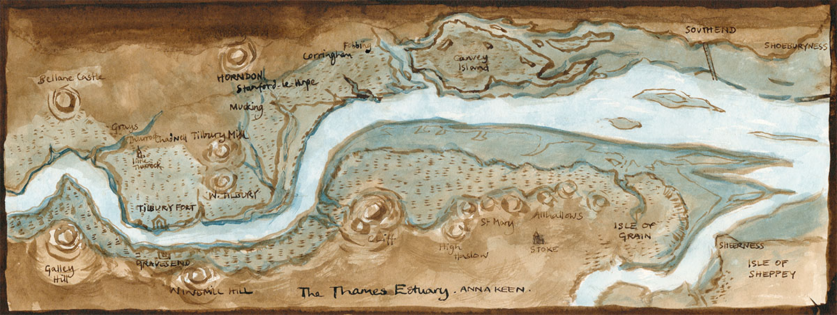
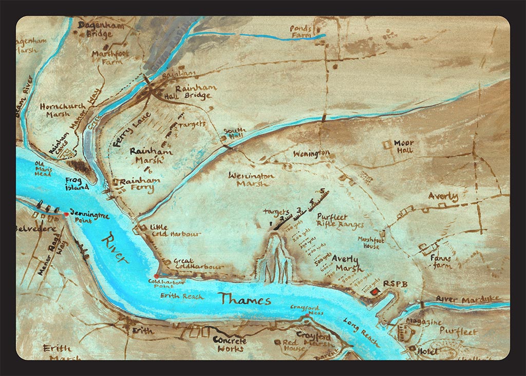
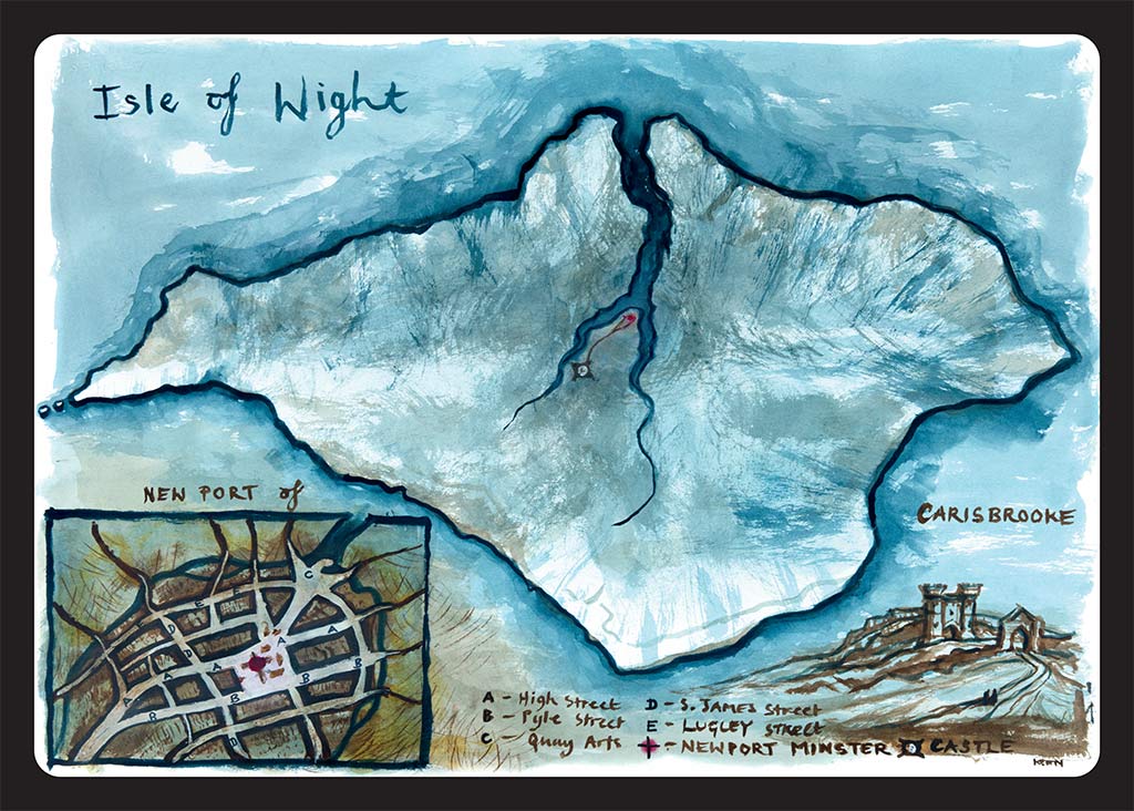
Forming part of Havering Riverside and bordering the Thames just west of Purfleet, are the Aveley, Wennington and Rainham marshes.
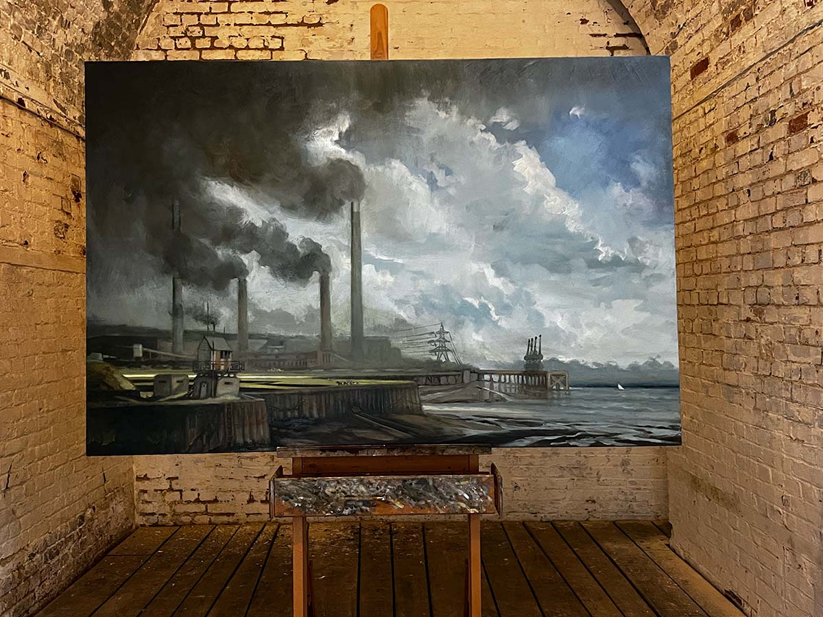
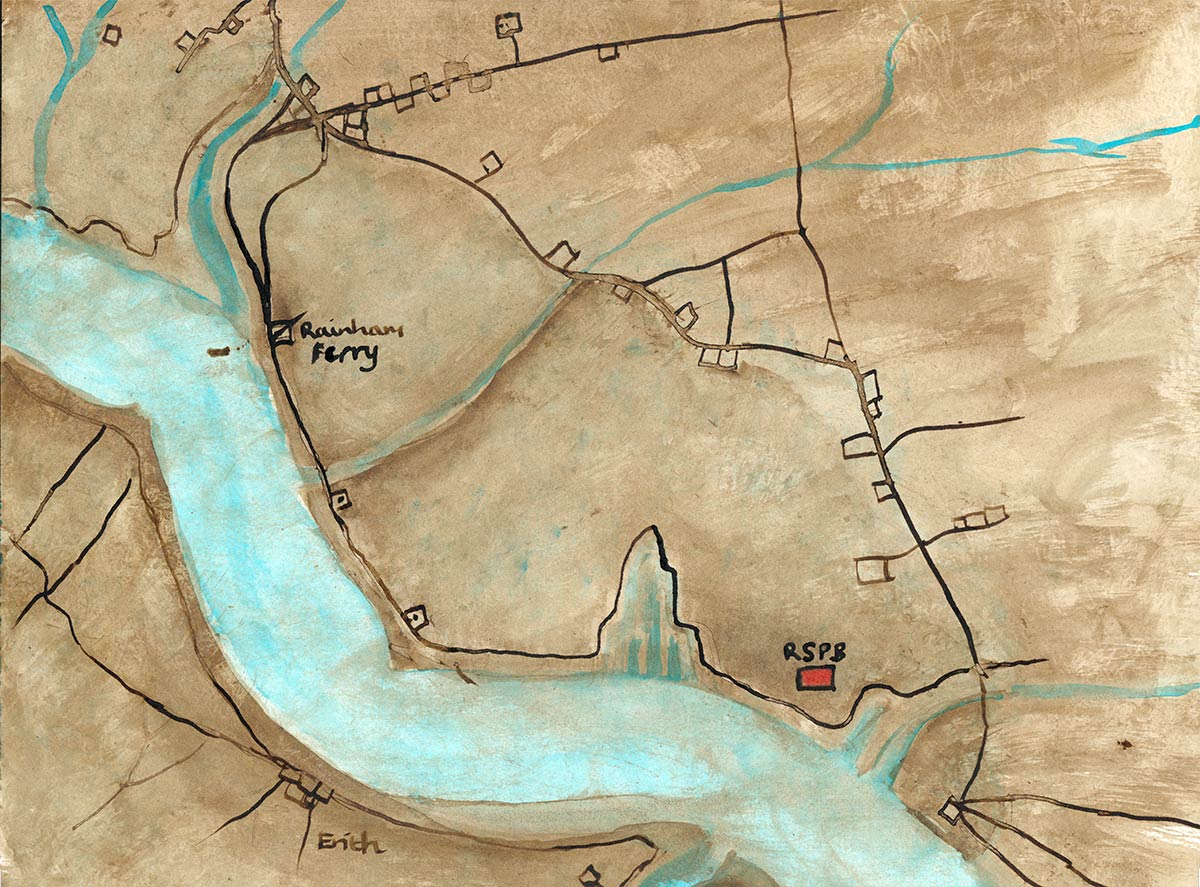
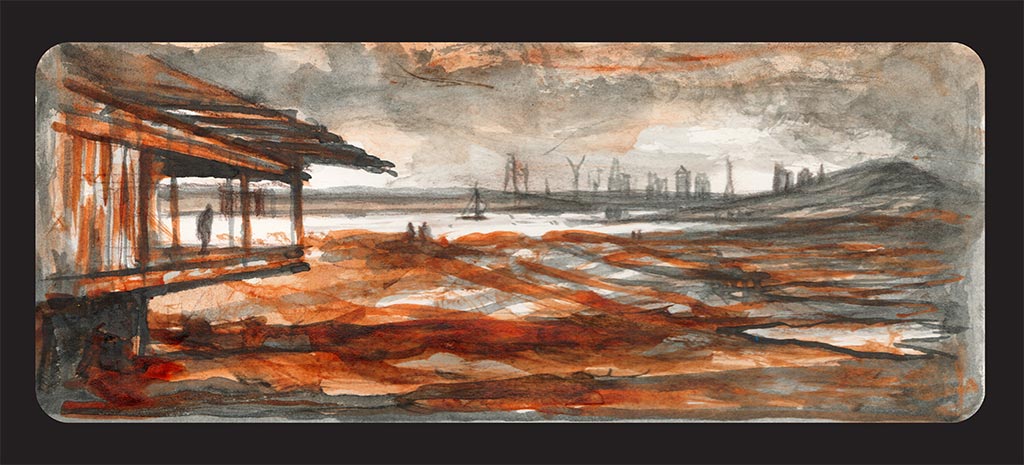
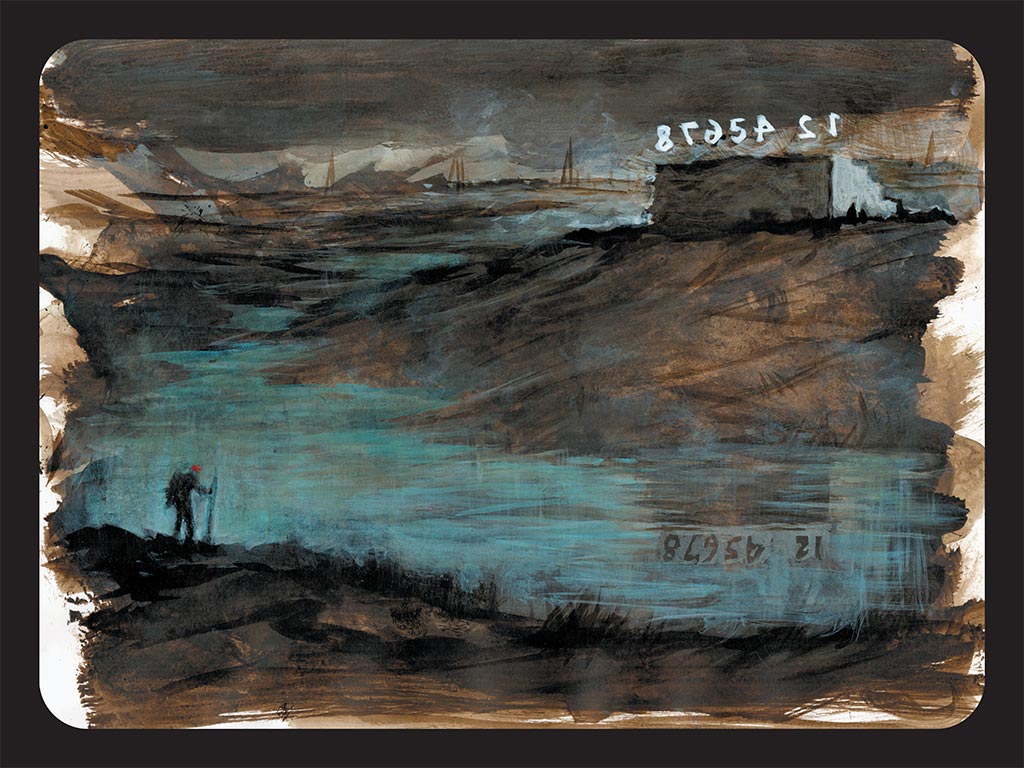
The artist Anna Keen is Wandering the Wilderness for the Totally Thames Festival 2022 in the RSPB Rainham, 18 miles from central London. Her Road-Signs are artistic waypoints set outdoors in the landscape and hidden in the wooden bird-hide. The strangely beautiful architecture of their iconic, carbon neutral building and cafe is set like a jewel in this urban fringe environment of Outer East London. Attracting people to the marshes to watch its 250 species of birds and walk in its ancient landscape, neither quite water or land, dominated from afar by the huge alien Rubbish-Mountain of Rainham landfill, which is too human for comfort.

There are many traces of Iron Age and Roman occupation in these marshes. Aveley is north of the river Mardyke (which as late as 1760 was tidal for about 5 miles). The remains of prehistoric elephants found there during gravel digging are displayed at the Natural History Museum in London.
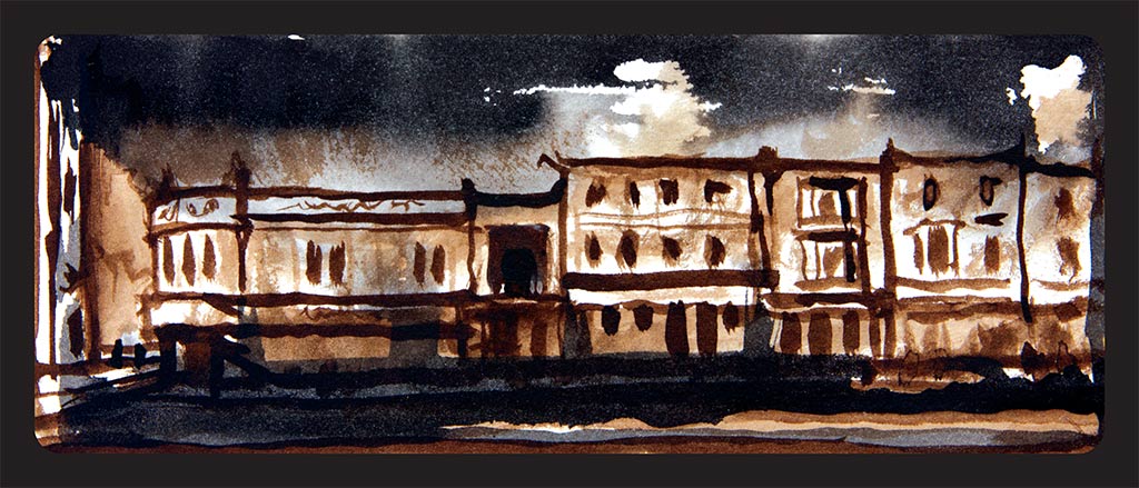
In 1273 Aveley manor had a gallows and a rabbit warren. There were two ale-tasters from 1519 to 1686, plus a poundkeeper, responsible for catching and ‘impounding’ stray livestock in the common pound, a ducking stool and a whipping post. In 1773 Marshfoot House was leased as a workhouse. From 1806 Aveley, West Thurrock, and Rainham leased Noke House, Wennington, as a joint workhouse. Harry Noke of Upminster, by will proved in 1595, gave 20 lambs as stock to buy bread for the poor of Aveley and West Thurrock. In 1760, when the government was planning the powder magazine at Purfleet, an engineer reported that the Mardyke was very badly drained, mainly because the water mill at its mouth penned in the tides for 6 hours in 24. The mill was demolished in the following year. By the later 16th century the marshes were governed by a Court of Sewers whose jurisdiction extended from West Ham to Mucking. Aveley level, which formed part of that area, in 1563 ran from Rainham bridge to Grays’ bridge.

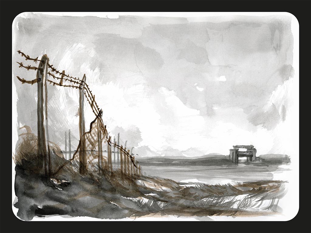
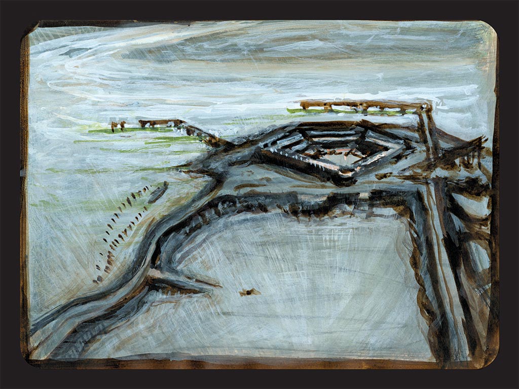
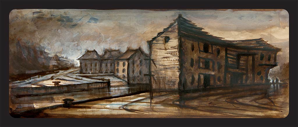
There was an extensive WW1 army training camp, a military hospital and the site of an anti-aircraft gun on the marshes. Purfleet Heritage and Military Centre is inside an enormous gunpowder magazine built in 1759 to store and supply the Navy and the Army. Their museum collection has a wide range of local history and military topics from the eighteenth century to the present day. On the RSPB site were the firing ranges. Huge structures with 8 huge 2m high wooden letters on each block. There were 5 blocks on Averly Marsh and 6 blocks on Rainham marsh. Both facing inwards towards each other, with markers every 100 yds for aiming. The numbers could be seen backwards from the A13 and in this surreal and desolate landscape, sometimes a number would blow away, a sign and a portent…”The night…is filled with bestial watchmen, trammelling the extremities and interstices of the timeless city, portents fallen…” Samuel Delany

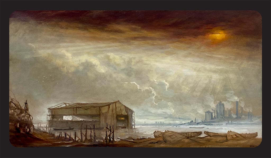
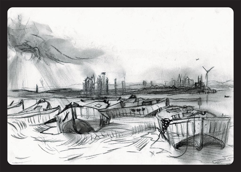
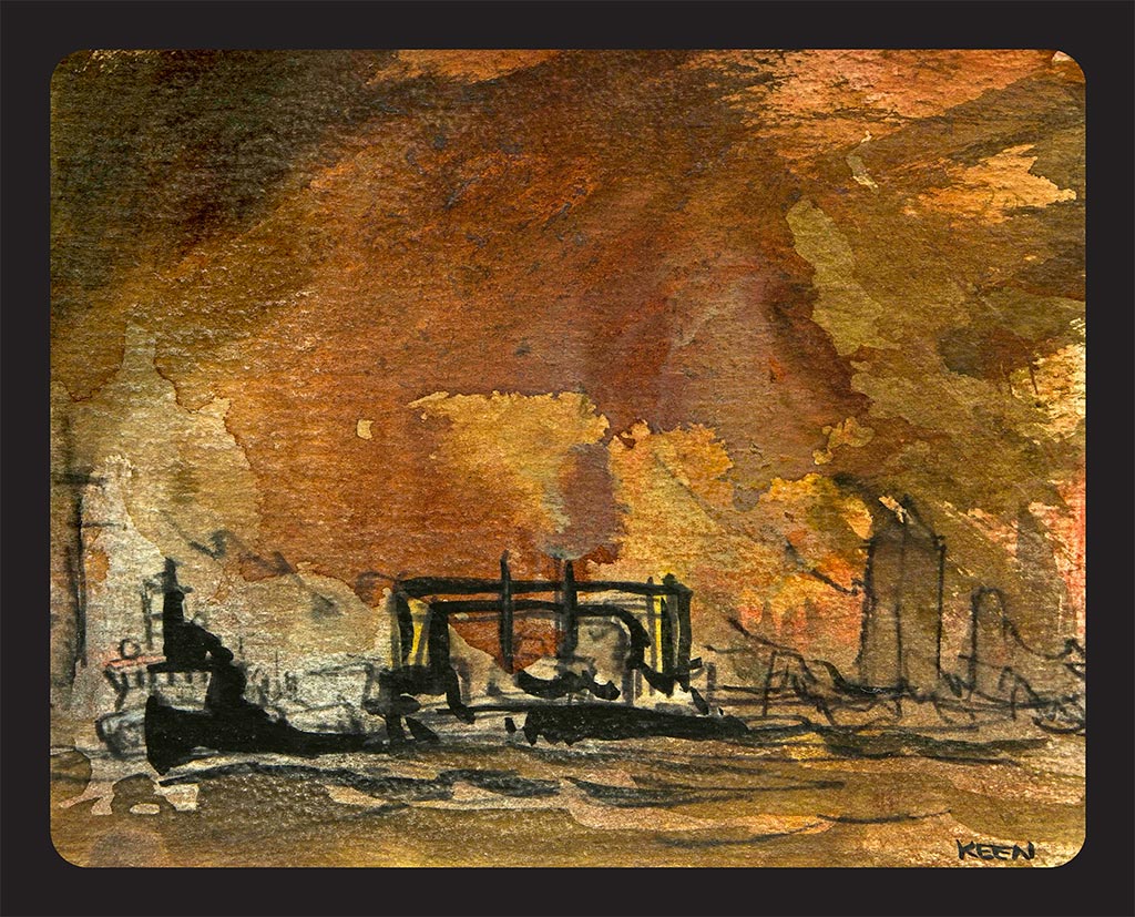
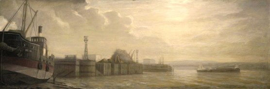
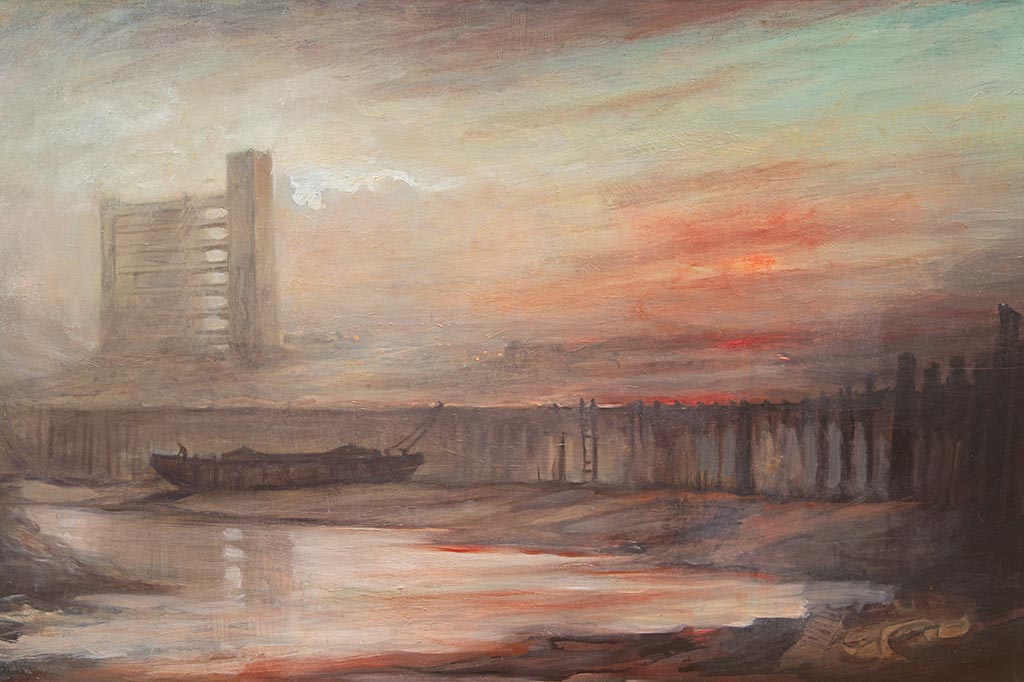
Ferry Lane still leads over the marshes from Rainham bridge and Rainham Manor (now owned by the national Trust) down to where the ferry was moored at the mouth of Rainham Creek in front of Frog Island. The ferry would cross towards Jenningtree Point near Erith on the other side of The Thames. Between the Tilda rice factory (built in the 1980’s) and the landfill barge’s water-shed, are a whole fleet of scuppered concrete barges stranded on the mud. These were used as part of a Mulberry harbour during the Allied invasion of Normandy in 1944. The barges were utilised to shore up flood defences in 1953 but are now abandoned. Waste from London is brought up the Thames in barges and deposited in Coldharbour’s hinterland. Further along towards the RSPB, is Coldharbour Point, and both Little Cold Harbour and Great Cold Harbour are marked on a map from around 1560.
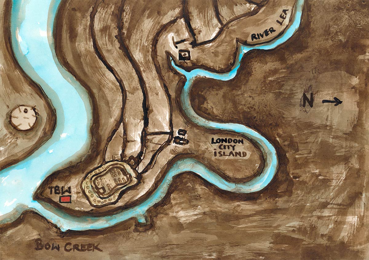
The London Loop is a walking route of about 150 miles that entirely encircles Greater London, beginning at Erith and ending on the opposite bank of the river at the RSPB visitor centre.

Trinity Buoy Wharf

tbw-logo

Anna Keen is Wandering the Wilderness for the Totally Thames Festival 2022 in Trinity Buoy Wharf, near Docklands. Her ART Road-Signs are waypoints set outside in the landscape, at this magnificent confluence of the river Lea and the river Thames.

Opening hours: daily 7 am – 7 pm
Address: 64 Orchard Place, Poplar, London, E14 0JW (directions)

MORE INFO

anna-keen-blackwell-shipyards
b) Trinity Buoy Wharf and Orchard Place Wharf’s Caisson Gate

A caisson is a form of lock gate. It consists of a large floating iron or steel box. This can be flooded to seat the caisson in the opening of the dock to close it, or pumped dry to float it like a boat and allow it to be towed clear of the dock.

anna-keen-pura-food
c) Pura Food Factory, River Lea

Pura Foods’ used to be called the ‘Pure Lard Company’. This huge factory full of steaming and smoking chimneys, creaked, groaned, whistled and hummed, bustling right up to the edges of what is now called ‘London City Island’. It covered the whole loop and was built upon the ghostly vats of boiling blubber brought up The Thames by the the Greenland Whalers.

anna keen thames yards
d) ‘Vic 56’ the last steam tug on the Thames

Vic 56 was the last steam tug on the Thames and a Dunkirk Little Ship. Technically a steam coasting lighter or a “puffer”. She is one of the 98 Victualling Inshore Craft built to the orders of the ministry of war transport between 1941 and 1945. There are no modern navigational aids, apart form the VHF radio which is essential on the Thames. VIC 56 never possessed radar or an echo sounder. She was moored at Trinity Buoy Wharf when I was there 20 years ago, and I sailed in her, watching the blackened, sweating men shovel rugby ball size pieces of Polish coal into her fiery boiler as she silently steamed upriver. The only noise was the long lamenting whistle as she ’let off steam’. In 1961 VIC 56 was selected to carry a jeep, sectioned hut and stores to the uninhabited island of South Rona in the inner Hebrides. It was the first stage in establishing an acoustic signature monitoring station still critical to today’s Royal Navy. The hold, engine room and cabins are unaltered since naval service – VIC 56 is the only VIC vessel to survive in this condition.

anna-keen-river-lea
e) The river Lea and Balfron Tower

Balfron Tower, once rife with drug addicts and poverty is now a Grade II* listed building designed  by the Brutalist Architect Goldfinger in 1963 for the London County Council. It is sister to The Trelick Tower in West London.

anna-keen-thames-barrier
f) The Thames Barrier in the Millennium year

The Thames Barrier spans 520 metres across the River Thames near Woolwich with 10 steel gates that can be raised into position across the River Thames. When raised, the main gates stand as high as a 5 storey building and as wide as the opening of Tower Bridge. Each main gate weighs 3,300 tonnes.The Environment Agency receives information on potential tidal surges from weather satellites, oil rigs, weather ships and coastal stations. They can forecast dangerous conditions up to 36 hours in advance. The barrier will close just after low tide, or about 4 hours before the peak of the incoming tide surge reaches the barrier. Information comes from a range of mathematical computer models that forecast expected sea and river levels. This is supplemented by data from the Met Office and real-time information provided by the UK National Tidegauge Network This hydrological and meteorological data is fed into the control room every minute from a wide network of tide and river pressure and wind gauges. The barrier has no individual trigger level for closure. The closing process is guided by a mathematical matrix that considers the river flow, tide and surge at the time. The final decision for closure lies with the Thames Barrier Duty Controller.

anna-keen-O2-millenium-dome
g) Storm Eurydice rips apart The Dome

The Dome is visible from space. The roof and its supports together weigh less than the air inside. Located on Greenwich Marsh, the windswept peninsular was once a vast former gasworks. In 1988 contaminants were found including solid ferrous cyanide, coal tars, mineral oils, benzene, polychromatic hydrocarbons, phenols, foul lime (from passing gas through crushed chalk for purification) and heavy metals.

anna-keen-barking-creek-flood-barrier
h) Barking Creek Flood Barrier

The River Roding is tidal from the Barking Barrage weir to the end of the river where it is known as Barking Creek. Here it joins The Thames and is part of the flood defence system for London as well as protecting Barking. It is normally closed before the Thames barrier. Completed in 1983, it is about 60 metres high (it needed to be this size to allow shipping to reach the Town Quay in Barking further upstream). In the 1850s the creek was home to England’s largest fishing fleet. The fish were landed at the Town Quay and stored in ice houses prior to being transferred to London’s fish markets. It is where the largest Sewage works in Europe unleashes its ‘outfall’ into The Thames.

anna-keen-thames-sun2
i) Rising Sun and Rubbish Barges at Walbrook Wharf

Walbrook Wharf is the ancient confluence of the Sacred River Walbrook which still runs beneath the City of London albeit in a culverted storm and sewage sewer whose outlet is at the foot of Cory’s Rubbish Barges, close to Tower Bridge. In total, Cory operates a fleet of five tugs, more than 50 barges and in excess of 1,500 containers. This fleet is used to transport non-recyclable waste from waste transfer stations along the River Thames to Cory’s energy from waste facility in Belvedere. These same barges and tugs also transport the ash resulting from the energy recovery process further down the Thames to Tilbury where it is processed into aggregate for the construction industry. This use of the river removes around 100,000 vehicle journeys from London’s roads each year. The name Cory has Greek origins and is the maiden name of the goddess Persephone, the wife of Hades, king of the underworld. The story is told of how Persephone was gathering flowers in the Vale of Nysa when she was seized by Hades and removed to the underworld. Upon learning of the abduction, her mother, Demeter, in her misery, became unconcerned with the harvest or the fruitfulness of the earth, so that widespread famine ensued. Zeus therefore intervened, commanding Hades to release Cory Persephone to her mother. But because she had eaten a single pomegranate seed in the underworld, however, she could not be completely freed but had to remain one-third of the year with Hades. The name may also have origins from the Gaelic word coire, which means “in a cauldron”, or “in a hollow”.

Trinity Lighthouse was built in 1864. This experimental lighthouse was used to train lighthouse keepers and test new lighthouse technology, not as a navigational aid. Originally, moored alongside was the Trinity House Yacht which serviced and maintained the buoys. In 1869 Trinity House set up an engineering establishment to test and repair new iron buoys. By 1875 the works had extended into the neighbouring property that had previously been the Green’s Shipyard site.
The depot was responsible for supplying and maintaining navigation buoys and lightships between Southwold and Dungeness.The depot closed on 3rd December 1998 when the London Docklands Development Corporation purchased the site. Urban Space Management took on the site as a long term lease in the same year. Trinity Buoy Wharf is now an arts and culture venue and hosts Longplayer, a thousand year long musical composition, which began playing at on 31st December 1999. Moored alongside is LV95 Lightvessel, a recording studio and in the past LV93 was also moored there, before moving to the Royal Docks. Bow Creek is one of the names given to the last two and a half miles of the river Lea before it enters The Thames beside Trinity Buoy Wharf Once a busy waterway full of barges trading with mills, warehouses and factories along the river bank, The river Lea is one of the oldest navigational routes in the country, its records date back to 1190. In 1665 the river bargemen were given the right to access the Thames without help from the Thames Lightermen in recognition of the bravery they had shown bringing food to London during the Plague.

A ‘London City Island’ mysteriously appeared one day in ‘real state rebranding’ in Bow Creek, on the double hairpin bend of the river Lea. Tightly packed skyscrapers have replaced the oil and fat factory ‘Pura Food’ which used to be called the ‘Pure Lard Company’. This huge factory, full of steaming and smoking chimneys, creaked, groaned, whistled and hummed right up to the edge of the ‘island’ like demented inmates of Alcatraz waiting for the chance to escape.

It covered the whole loop of London City Island and was built upon the ghostly vats of boiling blubber brought up The Thames by the the Greenland Whalers. English National Ballet dancers now leap and pirouette beside the “hardly human, incarnate mushrooms” as the locals were described by father Lawless in Booth’s Enquires into ‘The religious life of London’ in 1904.

Strangely, this iconic double loop does not even exist on an old map of the 1700’s, it is just marked as Abbey Marsh and the Plaistow Levels. ‘Orchard House’ with its trees surrounded by a ring-ditch is also marked next to where Trinity Buoy Wharf is now. The only other notation nearby on that map was ‘Copperas House’ and another huge factory complex. Copperas is produced from pyrite in coal and iron. The green crystals of hydrated ferrous sulphate is also known as Green Vitriol. Pyrite has been used since classical times to manufacture copperas. Iron pyrite was heaped up and allowed to weather (an example of an early form of heap leaching). The acidic runoff from the heap was then boiled with iron to produce iron sulfate. Vitriolic waters can produce both green vitriol (sulfate of iron), and blue vitriol (sulfate of copper). This bluish-green crystalline compound is used in sewage and water treatment and as a pigment and fertilizer. It is also used in medicine to treat iron deficiency. In the eighteenth century vitriol was needed for manufacturing chemicals like nitric and hydrochloric acids, and in an early industrial process for making washing soda. Hydrochloric acid was the starting point for chlorine production and the gas made was in turn used in a textile bleaching process. The synthesis of important fertilisers in the nineteenth century, like ammonium sulphate and super-phosphate, required large amounts of sulphuric acid. I distinctly remember the curious, oily smell which was oddly comforting, smearing itself on the back of my throat 20 odd years ago as I walked down to my little boat and studio at TBW. I wondered why there were massive black tanks with skulls and crossbones, dead fish and trees drawn upon them, until I read of the reaction between sulphuric acid and vegetable oils, which is quite complex, but renders them transparent.

Newport – IOW

a) The Red City map of Newport
Newport lays Land-Locked in The Centre of the Isle of Wight, yet twice a day The Tidal River Medina breathes The Sea deeply into Sea Street and its brick-red core.

logo-quay-arts
logo-historic-england
anna-keen-newport-carisbrook-map
b) The New Port of Carisbrook Map, Newport

Up St.Catherine’s Down the River Medina springs from the white chalk cliffs in the South of the Isle of Wight.

anna-keen-the-minster-st-thomas-square-newport
c) The Minster, St Thomas’ Square 

On the hill between the two rivers, where the land rises, stands the Church Minster. For at least 800 years  a church has stood on this sacred place.

Anna Keen, Old Literary Institute Newport
d) Old Literary Institute, Newport

Designed by John Nash 1811. At street level the ‘rusticated arcade’ of 5 arches transforms Newport into Italy.

anna-keen-monument-queen-victoria
e) Monument to Queen Victoria, Newport

Percy Stone’s three bronze lions crouch at the corners of the triangular plinth of The Monument, above them stand three bronze figures.

Anna-Keen-The-Unintegrated-Shadow-of-Newport
f) The Unintegrated Shadow of Newport

Pyle street’s multi story carpark looms like the Egyptian temple of Karnak. Its vast dark entrance and blank facade outstares The Church Minster.

anna-keen-st-james-square-newport
g) St James’ Square, Newport

Newport was named ‘Medina’ by the Romans, probably from the Saxon word ‘Medene’ meaning middle.

anna-keen-old-town-hall-newport
h) Old Town Hall, Newport

In Medieval times the town of ‘Medina’ was re-named ‘The New Port of Carisbrooke Castle’.

anna-keen-high-street-pyle-street-newport
i) High Street and Pyle Street, Newport

Castle Road splits into High Street and Pyle Street which run either side of the central Church Minster.

anna-keen-the-high-street-newport
j) The High Street, Newport

High Street ends at Holyrood (Holy Road) and Quay Street, which both lead to Sea Street and the New Port. 

anna-keen-quay-arts-sea-street-newport
k) Quay Arts, Sea Street, Newport

The River Medina’s High and Low Water Marks are currently being mapped by the Ordinance Survey team.

Newport lays Land-Locked in The Centre of the Isle of Wight, yet twice a day The Tidal River Medina breathes The Sea deeply into Sea Street and its brick-red core. The river almost severs the island in half as it travels Northwards towards Cowes and the Solent. Its only tributary is Lugley Brook and it is at the ‘confluence’ of these two rivers that the place we call Newport was founded in the Stone age, around 2.5 million years ago.In the 1920’s at least 64 hand-axes and 16 Levallois flakes from the Palaeolithic were found and In 2006 the BBC reported “School children have found prehistoric stone tools and Elephant teeth at Great Pan Farm, Newport”.
On the hill between the two rivers rises The Church Minster. For at least 800 years a church has stood on this sacred site. It is civically recognised as the main Anglican church on the Isle of Wight.

The Old Literary Institute was designed by John Nash 1811, its three central windows are divided by Tuscan pilasters, while at street level the ‘rusticated arcade’ of 5 arches transforms Newport into Italy.
Unveiled in 1903, two years after the death of Queen Victoria, Percy Stone’s three bronze lions crouch at the corners of the triangular plinth of The Monument; above them stand three bronze figures. Stiff-leaf foliage in the Art Nouveau style and a Gothic tabernacle with narrow gabled niches is crowned by a spirelet.
Not usually known for their architectural value, as Architectural Record noted, “In the Pantheon of Building Types, the parking garage lurks somewhere in the vicinity of prisons and toll plazas.” Subjected to the heavy and shifting loads of moving vehicles, they must bear the associated physical stresses. The earliest known multi-story car park was opened in London in 1901.
Pyle Street’s multi story carpark looms like the Egyptian temple of Karnak. Its vast dark entrance and blank facade outstare the Church Minster.